Studied from its original page
Radial anamorphosis of travel time
Accélération des voyages en France depuis 200 ans (plate title) · cartes concentriques (the legend) · carte rétractile (the legend)
- Made by
- Ministère des Travaux Publics (Album de statistique graphique, directed by Émile Cheysson)
- Year
- 1888
- Field
- Thematic maps
- Kind
- Map
- Room
- Places
What it shows
France drawn six times over, each outline stretched along every line from Paris to a city by how long that journey took in one era.
How it is read
Follow one line through the outlines to see how much faster that journey became, and compare lines to see which directions sped up most.
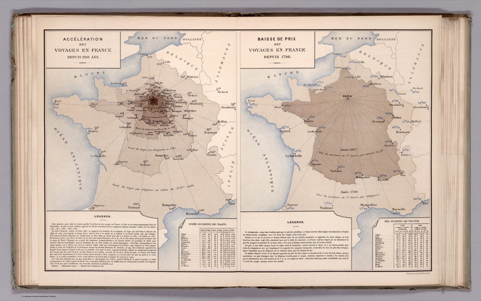
See the original page — left half of the spread; legend lower left
Published 1888 (A) and a French government work well before 1955, with the directing author Cheysson dead since 1910 (B).
The data it needs
destinationidentity · categoricalbearingray angle (from geography) · quantitative · degrees from the origineraseries · temporal · datecostdistance along the ray · quantitative · hours or francs
Built in 6 steps, as its maker described
left half of the spread; 'Légende' and table 'Durées successives des trajets' below it
20 other forms share this skeleton
Source
Album de statistique graphique 1888
Attribution less certain: contested, or no single inventor recorded